Geomagnetic Parking Guidance for Residential Communities
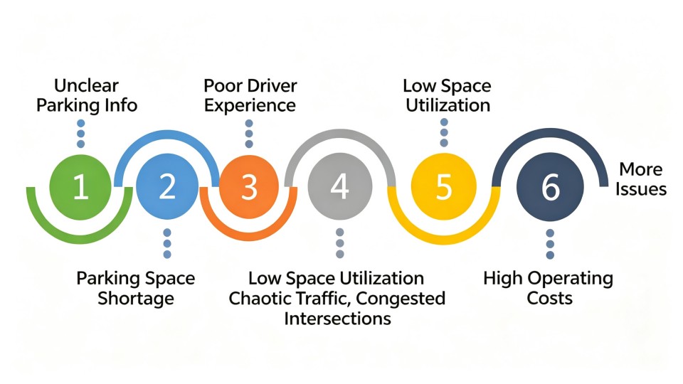
As urbanisation continues and vehicle ownership rises, parking difficulty in residential communities has become a major community-management and public-service issue.
Outdoor parking areas in enclosed residential developments commonly suffer from long search times, poor user experience, internal congestion,
low space utilisation and high labour costs. Property managers cannot obtain an accurate, timely view of space status, which affects residents' daily travel and slows smart-community upgrades.
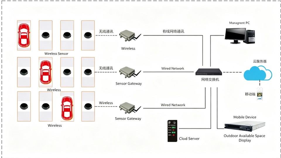
Technology path of the geomagnetic parking-guidance system
Ruanjie Intelligent's geomagnetic parking-guidance solution combines dual-mode geomagnetic detection, visual guidance and smart-platform management.
Real-time space sensing, rapid data aggregation, intelligent terminal guidance and back-office management form a closed parking-guidance loop across the site.
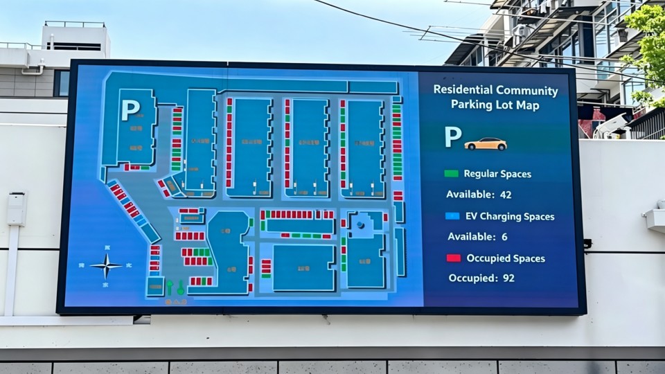
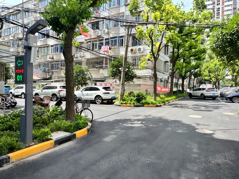
Know before entering: An entrance display shows the number of available spaces in real time, allowing drivers to plan their route before entering.
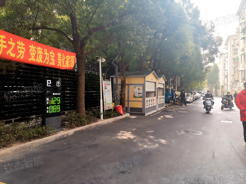
Follow the signs directly: Guidance displays at each intersection use numbers and arrows to show available spaces in each area and direct vehicles along the shortest route.
Avoid blind searching: Drivers do not need to circle narrow aisles repeatedly. Less time spent in areas with poor visibility reduces the risk of scrapes and collisions.
Accurate sensing: dual-mode detection with accuracy of at least 99%
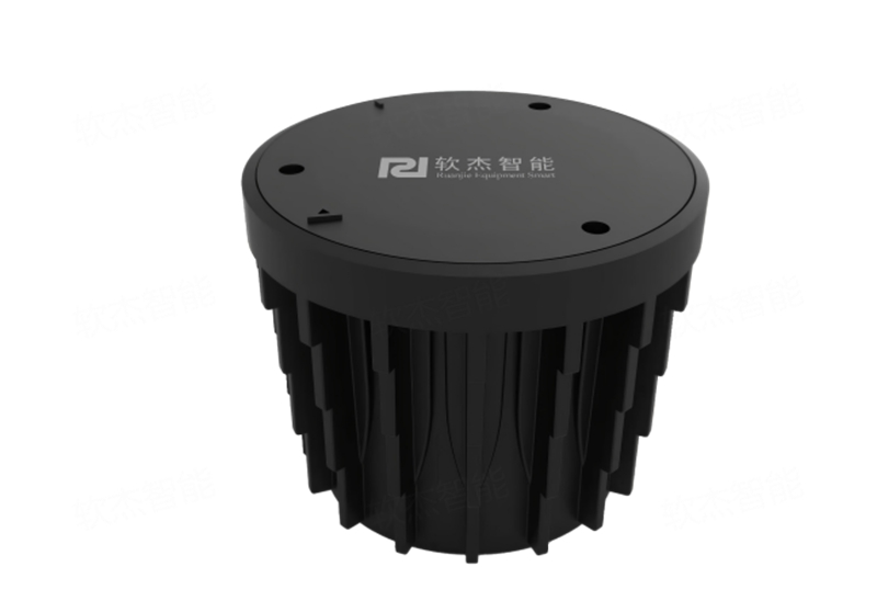
Each space is equipped with a dual-mode geomagnetic detector. Wireless microwave radar and geomagnetic sensing work together to detect different layouts,
including straight and irregular spaces. The system remains stable and reliable despite common interference sources such as underground rail lines, metal canopies and manhole covers.
Rapid aggregation: wireless transmission for easy installation
Detectors send status data to outdoor area controllers over RF wireless communication. No trenching or cabling is required, greatly reducing construction complexity and cost.
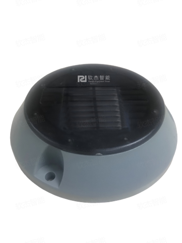
In-ground detectors are installed flush with the road surface, while surface-mounted detectors can be placed and used immediately, causing minimal disruption to normal community operations.
Intelligent guidance: graded prompts leading drivers directly to a space
The entrance display shows the total number of available spaces. Guidance displays at intersections use numbers and arrows to identify available spaces in each area and
direct vehicles along the shortest route, avoiding unproductive searching in blind spots.
Data management: cloud platform to support decisions
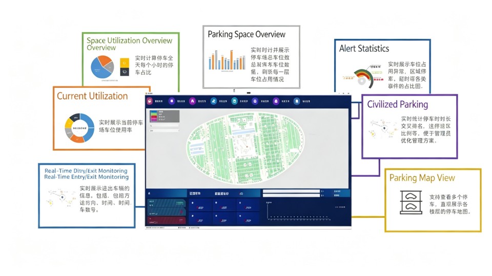
Site-wide space data is synchronised to the management platform. The platform provides an electronic-map view, time-based utilisation curves and historical reports,
supports multi-level permissions and connects to third-party data interfaces. These functions provide data support for refined property operations.
Core system advantages
Dual-mode detection with accuracy of at least 99%: Wireless microwave radar and geomagnetic detection are combined with an advanced space-recognition algorithm.
Accuracy exceeds 99% for different layouts, including straight and irregular spaces. The system is resistant to underground rail transit, metal canopies, manhole covers and communication base stations.
Industrial-grade protection for all-weather deployment: Detectors are rated IP68, controllers IP66 and guidance displays IP65. The operating temperature range is -30°C to +75°C,
and the equipment can withstand vehicles weighing up to 20 tonnes.
Long battery life and low maintenance cost: Built-in high-capacity lithium batteries provide three to five years of operation. Bluetooth commissioning and OTA remote upgrades reduce site visits.
Fully wireless architecture and short deployment cycle: Wireless communication runs from detectors to controllers. Under standard configuration, one controller can cover a large parking area.
Cloud management platform and data-driven decisions
Electronic-map visualisation: Shows the real-time distribution of occupied and available spaces across the site.
Time-based data analysis: Provides 24-hour, 7-day and 30-day utilisation curves to support operating decisions.
Multi-level permissions: Assigns functions by role for property, security and maintenance teams.
Open data interfaces: Pushes space data to third-party platforms and supports connection to city-level smart-parking networks.
Application value: service across the full deployment and maintenance lifecycle
For property managers:
Real-time visibility of site-wide space status and automatically generated operating reports
Higher space turnover and fewer resident complaints caused by parking difficulty
Online equipment-fault monitoring and alerts for more proactive maintenance
Responsive service 365 days a year, 24 hours a day
For residents:
Available-space count and location are visible immediately after entering the car park
Clear guidance remains available at night and in low-light conditions
Improved internal traffic flow and shorter entrance queues during peak periods
About Ruanjie
Shanghai Ruanjie Intelligent Equipment Co., Ltd. was founded in 2006. Using AI recognition and big-data processing as core technologies, the company develops smart parking
systems and has been recognised as a National High-Tech Enterprise and a Specialized, Sophisticated, Special and New Enterprise. Ruanjie researches, manufactures and sells smart
parking products under the Ruanjie brand. It has an experienced technical R&D team, dozens of invention patents and software copyrights, ISO 9001 certification, and products tested
and certified by the Third Research Institute of the Shanghai Public Security Bureau. Guided by the principle “Pursuing Excellence and Striving for Perfection,” Ruanjie continues to
invest in innovation and creates value through high-quality products and professional service. Its services cover parking reservations, off-peak space sharing, unified payment,
information collection and publication, space management, electronic maps, vehicle finding and available-space navigation, providing a complete integrated solution for city-level smart parking.